Clipper Race signs Nobeltec as official navigation software supplier
08 January 2015
We are proud to announce the appointment of Nobeltec as the Official Navigation Software Supplier for the 2015-16 race edition.
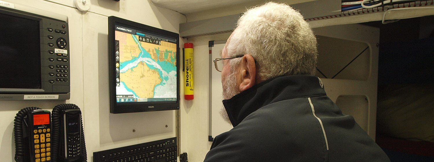
As they race around the globe, the Clipper Race fleet will use Nobeltec TimeZero Trident, with the add-on Sailing and Tactical Plus Packs. This is Nobeltec’s most dynamic and cutting-edge navigation software for competitive racing, and will assist teams as they seek out their quickest routes during the 40,000 nautical mile circumnavigation.
Sir Robin Knox-Johnston said: “I’m very pleased to welcome Nobeltec on board as our Official Navigation Software Supplier for the Clipper 2015-16 Race.
“I used NobeltecTimeZero Trident software on my own boat during the Route du Rhum race where I finished third in my class. I was very impressed with it and am confident that our teams will be guided safely and competitively round the world with it.”
Nobeltec is a world leading developer of PC-based marine navigation software programs and supplier of electronic charts, hardware, and accessories.
Maeve Lynskey, Marketing Manager for Nobeltec said: “Nobeltec is thrilled to be selected as the Official Navigation Software Supplier for the Clipper 2015-16 Race.“The Clipper Race is a truly unique challenge that gives amateur sailors the opportunity to sail around the world and we are confident that the Nobeltec TimeZero racing software aboard the fleet will allow the race participants to reach their full potential. We’re looking forward to a fast and exciting Clipper 2015-16 Race and a very successful partnership.”
Nobeltec’s innovative proprietary routing algorithm automatically calculates the fastest route from one point to another, taking into account variable data such as wind speed and direction, wave/currents conditions and boat polars.
Nobeltec TimeZero Trident software was specifically designed for yachts, mega yachts and professional users and features an ultra-fast chart engine which uses 3D chart rendering to provide an extremely realistic display of the boat’s surroundings. The patented PhotoFusion technology “fuses” high-resolution satellite photo information with chart data for a complete vision of water depths and coastal objects or obstructions.
The software also includes the Nobeltec GRIB Weather and Ocean data service which measures rain, cloud, air temperature, wind, waves, oceanic currents, pressure, SST and altimetry to plan the best routes in challenging conditions.
Nobeltec was established in 1993 by two ex-Microsoft engineers and avid boaters. The company’s full range of products includes marine navigation software, marine sensors and associated accessories, marine cartography and supplemental data, and is available globally from certified Nobeltec dealers.
For more information, visit www.nobeltec.com.
Join The Race